CLEVELAND, Ohio — A stalled front will influence the weather over Northeast Ohio going into the weekend, bringing the chance for strong to severe thunderstorms.
On Friday, the front will be positioned south of our region over the Ohio River valley, which will translate to cloudy conditions and scattered showers over Northeast Ohio in the morning.
Skies will clear by the afternoon, giving way to sunshine, low humidity and a refreshing breeze. High temperatures will be just shy of 80 degrees, making for a pleasant summer day.
Strong to severe storms Saturday
Saturday evening is shaping up to be stormy across Northeast Ohio, with the potential for a line of strong to severe thunderstorms to move across the area.
The stationary front to our south will lift northward as a warm front, bringing in humid, unstable air and favorable wind conditions for storm development. At the same time, a weak disturbance is expected to move in from the west and interact with the front, further increasing the chances for thunderstorms.
Damaging winds will be the main threat, but large hail and even a brief tornado can’t be ruled out,
according to forecasters
with the National Weather Service in Cleveland.
Heavy rainfall also will be possible, which could lead to isolated flash flooding, forecasters noted.
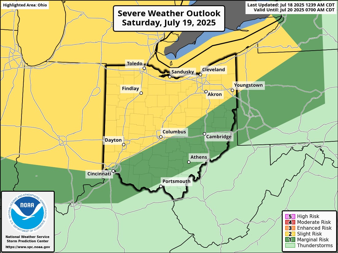
As a result, the
Storm Prediction Center
has placed a large swath of Ohio under a Level 2 out of 5 “slight risk” for severe weather.
High temperatures on Saturday will climb into the mid to upper 80s before the storms gradually wind down later in the evening.
Comfortable conditions to end the weekend and start the workweek
Shower chances will linger with cloud cover to start Sunday. Similar to Friday, precipitation chances will give way to sunshine later in the day with another round of more comfortable air moving into Northeast Ohio.
High temperatures on Sunday will be in the upper 70s and lower 80s.
The fair conditions will continue into Monday, with highs only expected to rise into the upper 70s for the start of the workweek.
Heat and humidity return later next week
The heat looks to return next week, with highs surging into the upper 80s on Wednesday and low 90s by Thursday.
By midweek, a dome of high pressure will build over the Ohio and Mississippi valleys, placing Northeast Ohio on its northern edge. At the same time, a weak front will linger across the Great Lakes, keeping the chance for isolated storms in play.
This pattern will bring hotter, more humid conditions to the region, with heat index values potentially climbing into the upper 90s or even near 100 degrees, forecasters said.
More
weather
-
Climate change brings more intense rain to Cleveland: What records show
-
Cold front brings breezy Thursday, hazardous beach conditions to NE Ohio
-
Public advisory issued for Edgewater Beach after sewage overflow into Lake Erie


